
Virtual Mapping & Boundary Line Services
Precision. Clarity. Confidence in Every Acre.
At Sentinel SkyWorks, we provide high-accuracy virtual mapping and property boundary visualization services grounded in Truth in Advertising for landowners, real estate professionals, developers, hunters, and investors. Using advanced geospatial tools, we create interactive digital maps and custom visual overlays that help users understand property layout, access, and features with exceptional clarity—without implying legal certainty.
Our mapping services are designed for informational and marketing purposes only and should not be relied upon for legal boundary determination. All visualizations are intentionally presented to enhance understanding while avoiding misrepresentation.
We generate clean, easy-to-read boundary outlines using publicly available GIS data and client-provided information. These boundary lines are illustrative references, not surveyed or legally verified property lines, and are clearly distinguished as such in accordance with Truth in Advertising standards.
Legal Notice: Sentinel SkyWorks, LLC is not a licensed surveyor, engineer, or architect. All maps, boundary lines, and visual overlays we produce are illustrative tools only and are not a substitute for a professional land survey, engineering analysis, or architectural determination. Please refer to the full disclaimer below.
What These Services Includes
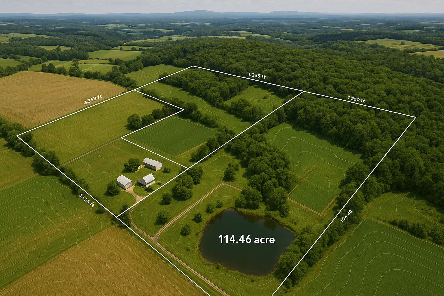
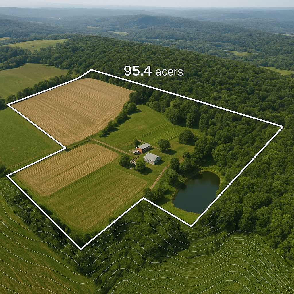
High-Accuracy Digital Boundary Mapping (Illustrative Only)
-
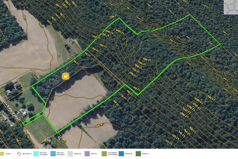
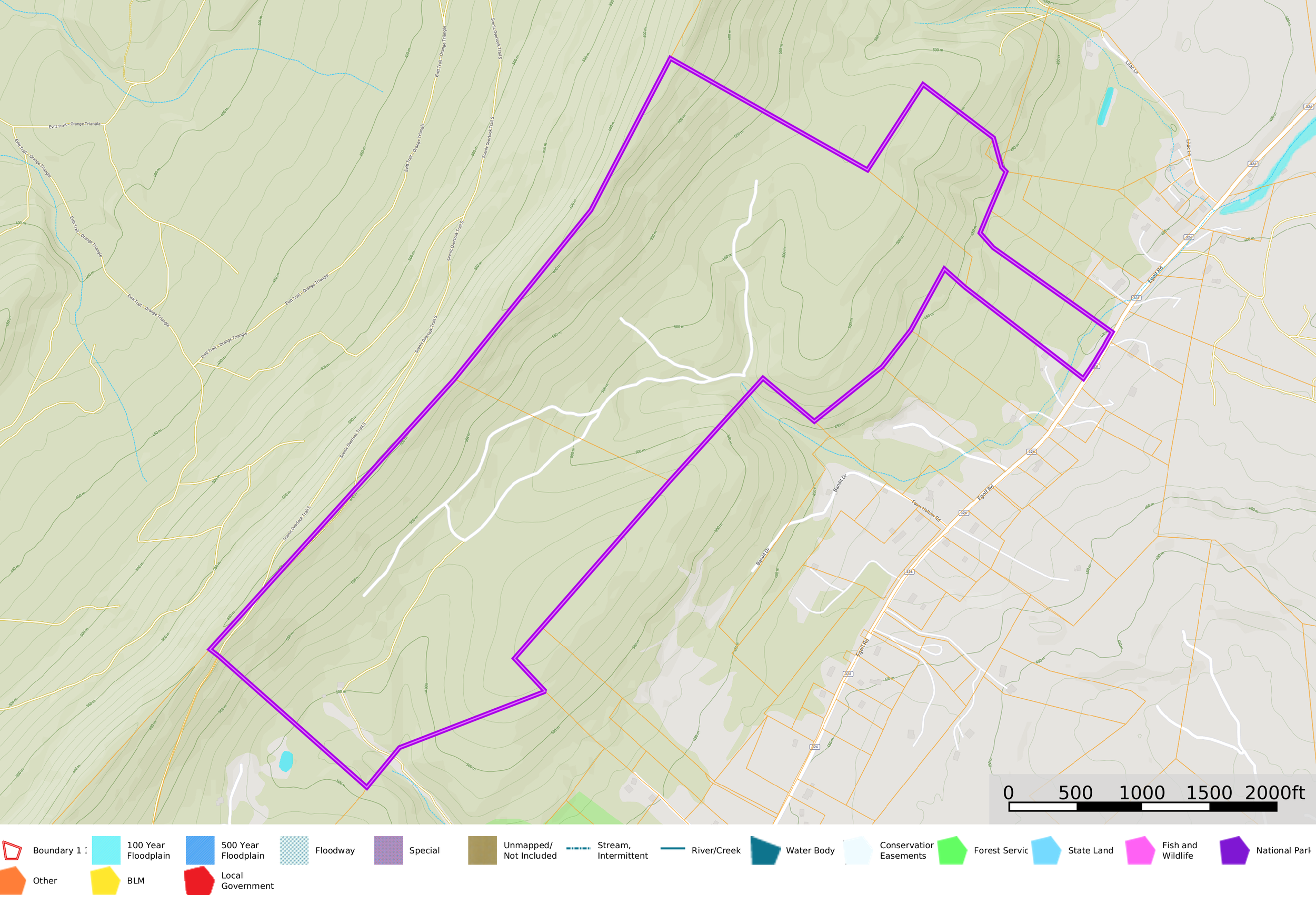
Interactive Virtual Mapping
Clients receive a professional, shareable interactive map including:
Property borders (illustrative)
Contours & terrain
Roads & access
Trails, features & landmarks
Water features
-
Marketing-Ready Boundary Overlays
We provide:
High-resolution aerial images
Bright, professionally drawn boundary outlines
Acreage, length & distance labels (approximate)
Satellite, topo, and hybrid map styles
Export-ready formats for MLS & Land.com
-
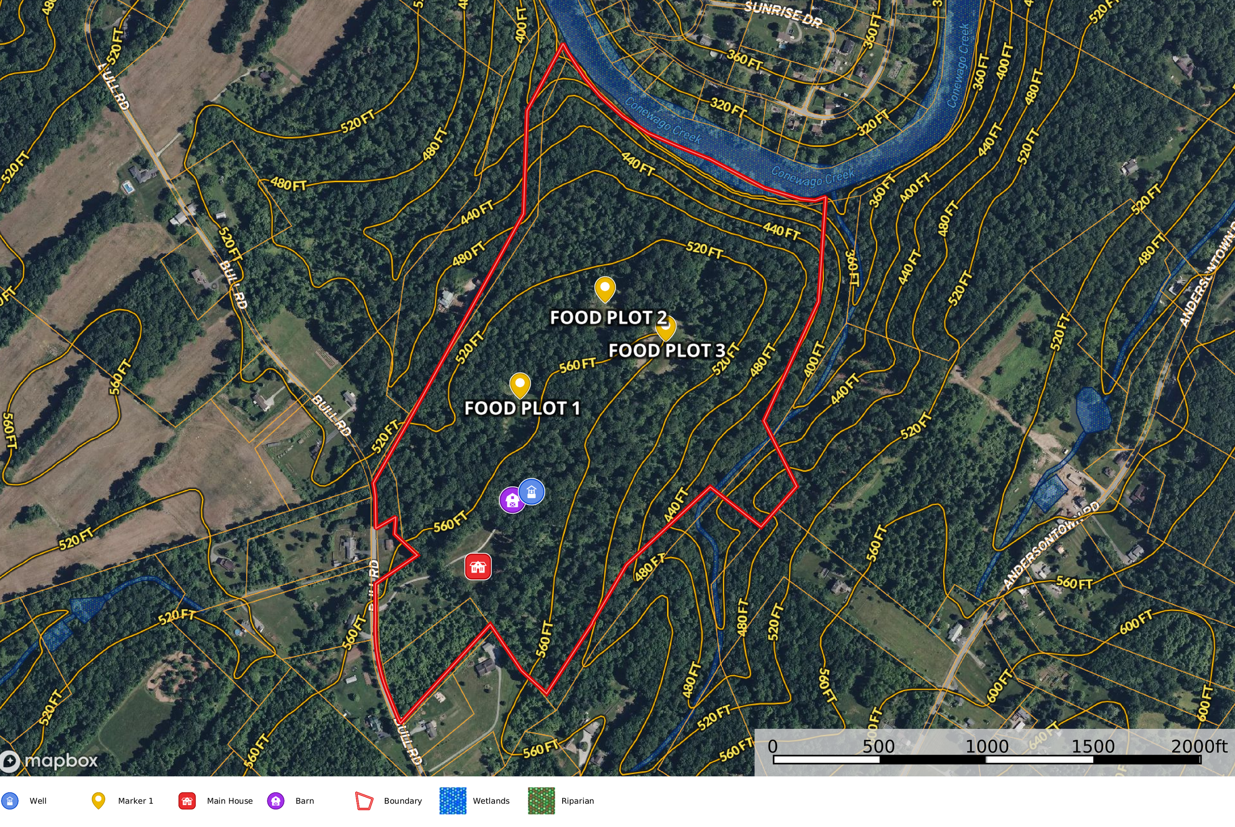
Custom Feature Markups
Illustrative feature markings such as:
Trails & access routes
Timber areas
Food plots
Potential building sites
Landmarks
Habitat features
-
Exportable Images & Video Layers
We can generate:
Boundary-annotated aerial stills
Map overlays
4K video with illustrative boundaries
Social media and listing graphics
Why Clients Choose Sentinel SkyWorks
✔ Professional mapping graphics - Readable, clean, modern, and ideal for marketing or planning.
✔ Rapid turnaround times - Most mapping packages completed within 24–48 hours.
✔ Enhanced property understanding - Perfect for showing potential buyers, agents, investors, or land managers.
✔ Not intended to replace legal surveying - All of our mapping is illustrative, ensuring transparency and compliance.
Deliverables You Receive
Every package includes:
Interactive Land.ID map link
High-resolution aerial map sets
Illustrative boundary overlays
Topographical mapping
Drone imagery (optional)
4K video with illustrative boundary lines (optional)
Perfect For:
Real estate listings
Landowners planning improvements
Hunters & outdoor managers
Developers & investors
Timber & habitat planning
Visual marketing & presentations
Understanding land layout
Full Legal Disclaimer:
Sentinel SkyWorks, LLC is not a licensed surveyor, engineer, or architect. All maps, boundary lines, measurements, annotations, topographical representations, and geospatial illustrations provided by Sentinel SkyWorks, LLC are approximate and for informational, illustrative, and marketing purposes only. These materials are not legally verified and do not represent or replace a professional land survey, engineering analysis, architectural evaluation, or legally recorded property boundaries. All clients and end-users are strongly advised to obtain an official survey from a licensed land surveyor for any legal, development, construction, or boundary-related decisions. Sentinel SkyWorks, LLC assumes no responsibility for the use, interpretation, or legal reliance on any mapping or visual materials we provide.