
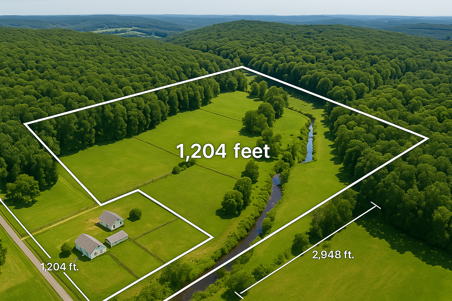
Acreage | Boundary Visualization
High-accuracy aerial mapping and visual overlays designed to help landowners, buyers, and professionals understand property boundaries clearly, confidently, and truthfully.
Sentinel SkyWorks provides specialized Acreage Boundary Visualization services grounded in Truth in Advertising, transforming complex parcel information into clear, high-impact aerial imagery for informational and marketing use. Through disciplined flight planning and advanced geospatial reference points, we overlay boundary lines, property corners, and acreage outlines onto high-resolution drone imagery—presented as visual references, not legal determinations.
These visualizations help clients better understand land size, access points, terrain features, and adjacent property relationships—enhancing clarity while avoiding misrepresentation. Our process combines FAA-compliant aerial imaging with publicly available GIS and cadastral data to produce accurate, visually intuitive maps that are clearly distinguished from surveyed boundaries.
Whether you are a landowner preparing to sell, a real estate professional marketing large tracts, a buyer evaluating parcel access, or a surveyor seeking reference documentation, Sentinel SkyWorks delivers professional, ethical visual tools that support informed decision-making and transparent communication.
Each project is customized to the property’s location and topography, offering multiple visualization options such as color-coded boundary overlays, acreage annotations, and contour perspectives. Deliverables may be exported as high-resolution images, interactive map files, or video fly-throughs for use in presentations and listings—clearly identified as visual aids.
While Sentinel SkyWorks applies mapping accuracy standards that exceed typical industry practices, we remain firmly committed to Truth in Advertising. All mapping and boundary visualizations are provided for illustrative and informational purposes only. Sentinel SkyWorks is not a licensed surveying firm, and our imagery should never be relied upon as a legal property survey or certified boundary determination. Our role is to provide accurate visual context, not legal verification.
Clients across Pennsylvania and neighboring regions trust Sentinel SkyWorks to bring clarity, transparency, and professionalism to land visualization. By combining advanced aerial imaging with disciplined geospatial workflows, we help property owners, agents, and investors see their land as it truly is—from above—while maintaining ethical representation and disclosure.